| IT | DE |
| IT | DE |

© StefanoZardini

Falzarego pass – Armentarola

Fabio Bernardi
Mountain guides Gruppo Guide Alpine Cortina d'Ampezzo
info@guidecortina.com - https://www.guidecortina.com/
      

This path satisfies many interests, such as the history of the Great War, botany and geology, in a natural, wild and  relaxing environment.
Please remember that the length is almost 13 km, with a height difference of 1380 m downhill, and 380 km uphill and that the estimated time is 6 hours and 30 minutes.
Tips:
- this route, although leading downhill, is recommended for well-trained hikers. It covers almost 13 km and at each step the muscles of the legs are burdened by your weight. The path requires a good ability to walk in the mountains;
- it is important to inquire about the weather conditions of the day because the tour rises up to 2746 m.
Good way!. 


Starting at the Lagazuoi Refuge, a trail leads down to the saddle Forcella Lagazuoi through the Open Air Museum of the First World War. Having reached the Lagazuoi saddle, proceed on the path n° 20.
Halfway, you pass the border between Cortina and San Cassiano, leaving thus the Nature Park of the Ampezzo Dolomites and entering the Fanes-Sennes-Braies Natural Park, where the hike will continue for the rest of the day.
Proceeding along the Val de Lagaciò you reach the homonyms lake at the foot of the imposing Cima Scotoni. From here take the CAI 20B path on the right, direction Forca del Lago, a path that climbs the gutter which separates Cima Scotoni from Piz dl Lech with narrow hairpin turns. Halfway up, a rocky outcrop overlooking the lake allows a wonderful view. 
Once you reach the Forca dl Lech, the magnificent glacial valley Valle de Gran Plann opens up, dominated by the Piz dle Conturines and the Pize de Ciampestrin. Continuing, you can admire the imposing Sella Group and the Marmolada.
So far the path has developed in a quiet up and down, crossing two small streams. Now it peoceeds downwards on steps among the rocks embellished by wild alpine flowers.

TECHNICAL DETAILS

Departure point
Falzarego pass / Lagazuoi refuge

Arrival point
Armentarola Hotel Sarè

Total duration
6,30 h

Path number
CAI 401, 20, 20B, 11, Troi de Meditazium

Total difference in altitude
↑ 360 m, ↓ 1380 m

Altitude at starting point
2100 m / 2752 m

Altitude at arrival
1660 m

Minimum altitude
1660 m

Maximum altitude
2746 m

Access
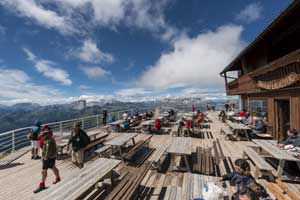
From the Falzarego pass, at 2105 m of altitude, go up to Mt. Lagazuoi with the Lagazuoi cable car and start your hike on the path n. 401 after a coffee with an incomparable panoramic view from the terrace of the Lagazuoi refuge at an altitude of 2752 m. 

Approach
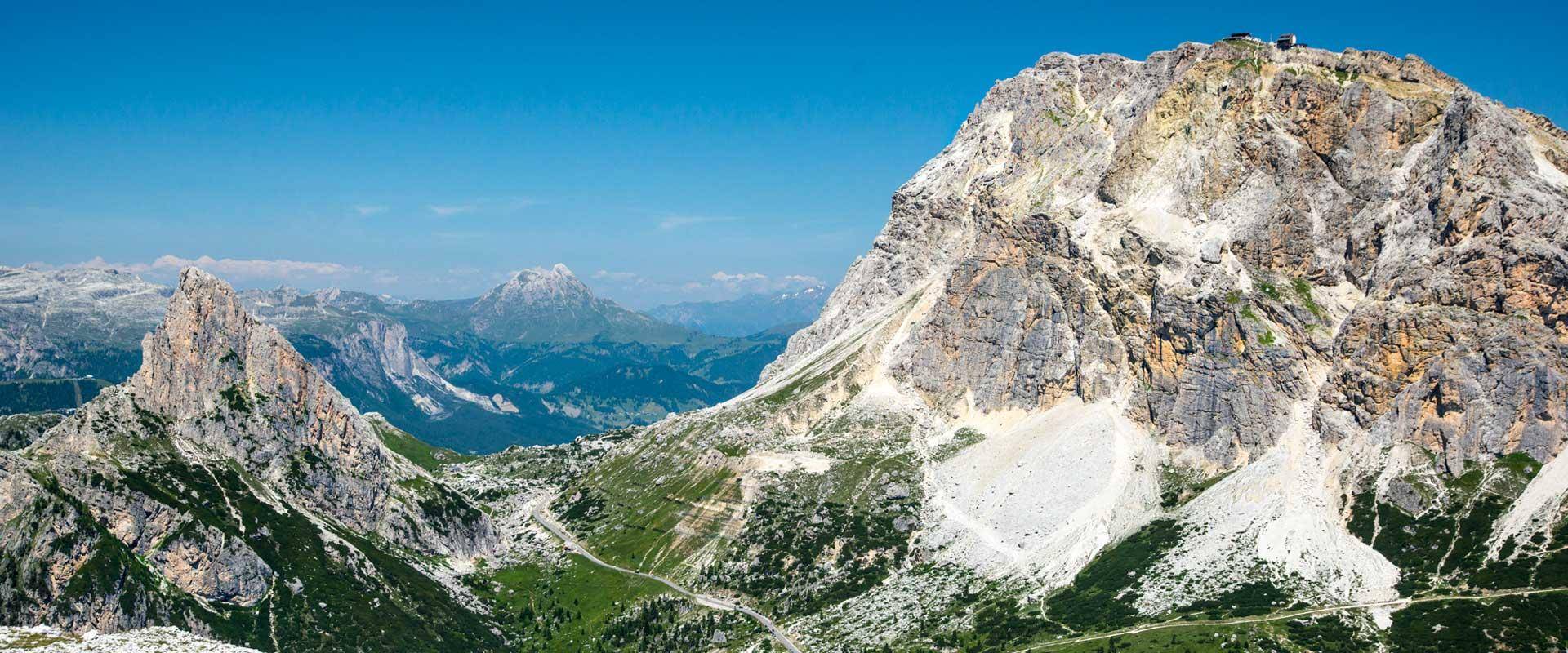
Having reached the Lagazuoi saddle (Forcella Lagazuoi), leave the path 401 and proceed on the paths n° 20 and 20B, direction Forca del Lago.

Return
From Forcella de Lech go downhill until you reach the wide valley Valle de Gran Plann. Then follow the path 11 on the left, which leads through Col de Locia to Armentarola. After 3.4 km you reach Capanna Alpina. and, with an imperceptible increase on the trail Tru de Meditazium, the hotel Sarè. Return to the Falzarego Pass by car or taxi bus.

Gear
Trekking shoes, backpack, water, snacks, packed lunch, clothes to change, rain jacket