As I wanted to interest my children in doing the new Via Ferrata on Mt. Sasso di Stria, I told them: "Let's go up and let us get eaten by the mountain".
"What does that mean, daddy?"
Indeed, to climb this mountain that dominates three valleys, Fodom, Badia and Ampezzo, first we have to cross it from north to south walking through the Goiginger tunnel, dug by the Austro-Hungarian soldiers.
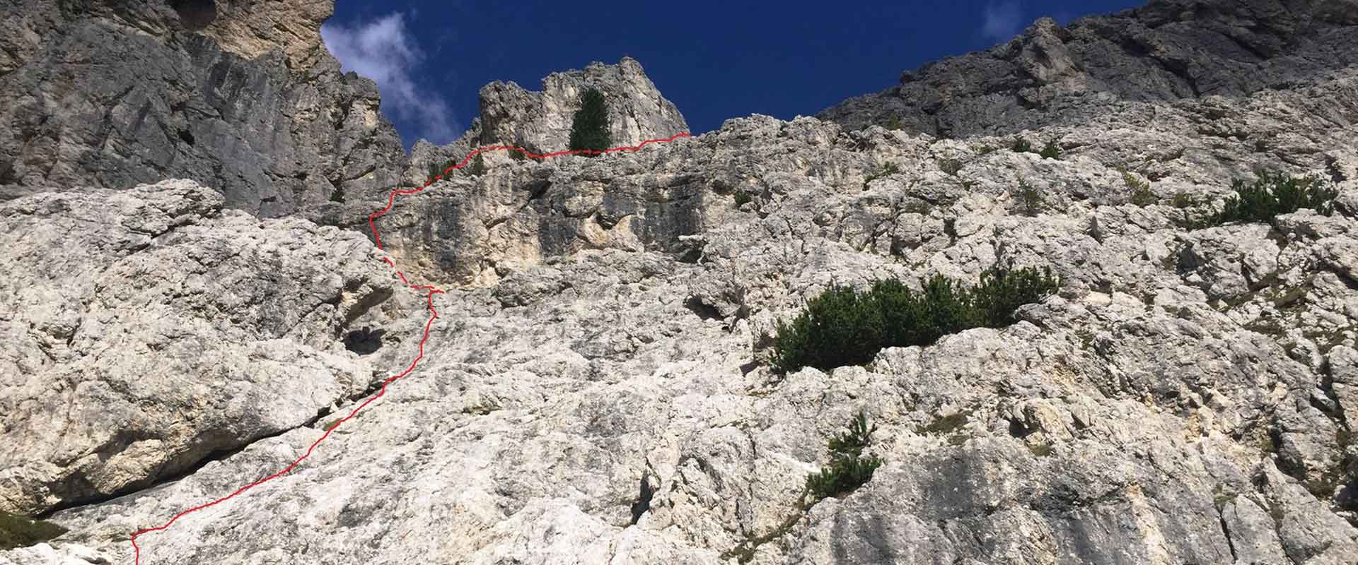
The entrance is a bit narrow but the exit is wonderful, it is a balcony studded with edelweiss that offers a privileged view. Then we walk on the west side around the mountain to the start of the Via Ferrata. The route runs on the ascent done by a troop of Italian soldiers who desperately tried to conquer the summit during the First World War. The last steps lead to a window, then the rock wall seems to constrict us again. But it is only the last stretch towards a trench and tunnel system, that leads us up to the summit of Mt. Sasso de Stria.
The new Via Ferrata Sottotenente Fusetti on Mt. Sasso di Stria was inaugurated on 18th October 2018.
The Via Ferrata Sottotenente Fusetti on Mt. Sasso di Stria is not only very interesting in terms of landscape and sporting challenge. Above all, it is of great historical-tactical interest as you walk in the footsteps of a hero of the First World War.
This Via Ferrata was built by two Alpini units searching for the remains of Second Lieutenant Mario Fusetti, the hero of Mt. Sasso di Stria awarded the Golden Medal of Honour.
DETAILED DESCRIPTION OF THE VIA FERRATA
a) 1st section: crossing to the left; length: 10,35 m with 8 anchorage points
b) 2nd section: vertical climbing that ends on a ledge; length: 43,5 m with 22 anchorage points and 8 plastic safety caps
c) 3rd section: straight-up but not completely vertical climbing: length: 25,2 m with 16 anchorage points
d) 4th section: crossing on a stomped track exposed to the right; length: 46,1 m with 30 anchorage points
e) 5th section: straight-up but not completely vertical climbing: length: 41 m with 27 anchorage points
f) 6th section: crossing to the left, the last part is vertical; length: 37,8 m with 22 anchorage points and 2 plastic safety caps
g) 7th section: vertical climbing; length: 35,7 m with 23 anchorage points and 10 plastic safety caps
This VIDEO with graphic simulation illustrates the role of the Sasso di Stria for the defence of the Valparola pass and the attack on the Martini ledge on Mt. Lagazuoi, shows the fortifications and the artillery on the Sasso di Stria:
THE SASSO DI STRIA
Difficulty
B (K2) - moderately difficult
Departure point
Tre Sassi fort, altitude 2168 m
Arrival point
Tre Sassi fort, altitude 2168 m
Total duration
1 h 50 m
Total difference in altitude
204 m
Minimum altitude
2168 m
Maximum altitude
2319 m
Access
Valparola pass
Approach
The access to the Via Ferrata alone is of great historical interest: to reach its access you first have to go through the Goiginger Tunnel with its artillery positions facing the Martini Ridge. Then you cross the Goiginger emplacement on the saddle, the military work of the First World War which made the Austrians on Mt. Sasso di Stria unassailable.
At the Tre Sassi fort, at an altitude of 2168 m, take the path towards Mt. Sasso di Stria. After 770 m you reach the Goiginger tunnel at 2255 m of altitude. The path is not difficult.
The entrance to the Goiginger tunnel is relatively narrow, but then you can walk through upright along its entire length of 350 metres. Only 140 meters from the exit of the Goiginger tunnel, at an altitude of 2287 m, you reach the Goiginger emplacement. The entrance to the Via Ferrata is located 810 m from the Goiginger emplacement.
The access time through the Goiginger tunnel is 1 hr.
Ascent
The ascent on this very well secured Via Ferrata is easy and takes about 45 minutes.
Return
Walking down along the trenches on the ridge of Mt. Sasso di Stria, you get back to the Tre Sassi fort.
Peak
Sasso di Stria, 2477 m
Orientation
southwest
Gear
a normal via ferrata kit and a torch or front lamp for getting through the tunnel