| IT | DE |
| IT | DE |

Photo by Giacomo Pompanin

The Kaiserjäger Path starting at the Falzarego pass

During World War 1 the Kaiserjäger path was the communication way of the Austrian soldiers between the bottom of the valley and the high emplacements on Lagazuoi and was used to supply food, munitions, and war equipment.
The path has now been repaired and can be travelled for its entire length.

Following a system of ledges, you first reach the famous suspension bridge, which is 10 meters long and 25 meters high, and then a steep and exposed but well-protected ledge.
Then you go across well-preserved emplacements and descend onto the Martini Ledge . Here you can see the big crater of the Austrian mine and the „Anticima“ emplacement with the entrance to the Italian tunnels. Then a steep path leads first to the ridge, then to the summit of Piccolo Lagazuoi and finally to the Lagazuoi refuge.

NOTES
Even if there are some exposed sections, this itinerary is also suitable for younger hikers because there are well placed fixed cables for support.

The route can be completed both uphill and downhill, using the cable car,  hiking on the Frontline Trail (path n° 401-402) or along the path that runs through the Anticima-Tunnel on the fore-summit.

Those who do not have the necessary equipment can rent it on-site at the Lagazuoi Info-point & Rental.
 

  • How to get up on the Kaiserjäger path and down through the Lagazuoi mine tunnel step by step: a VIDEO by 'Neve Italia - Una penna in Valigia>>>


HISTORICAL REMARKS ON THE KAISERJÄGER PATH  >>>


This VIDEO with graphic simulation illustrates the situation on the Martini ridge, situated halfway up the steep mountain face of the Lagazuoi, occupied by the Alpini in October 1915 to attack the Vonbank emplacement of the Austro-Hungarian defensive line at the Valparola pass: THE MARTINI LEDGE   >>>

TECHNICAL DETAILS

Difficulty
K1/A

Departure point
Falzarego pass, Lagazuoi cable car's parking (SS 48)

Arrival point
Falzarego pass, Lagazuoi cable car's parking (SS 48)

Total duration
3,15 h

Total difference in altitude
647 m

Vertical drop on the ferrata
280 m

Minimum altitude
2.107 m

Maximum altitude
2.778 m

Access
You can reach the starting point, Falzarego pass, from Cortina d'Ampezzo, Arabba or Badia by car or public means of transport.

Approach
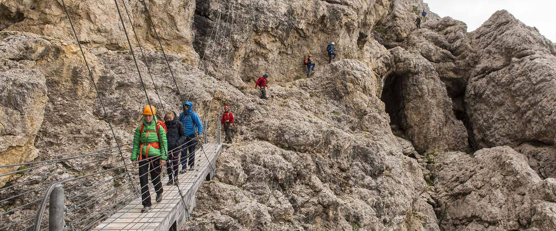
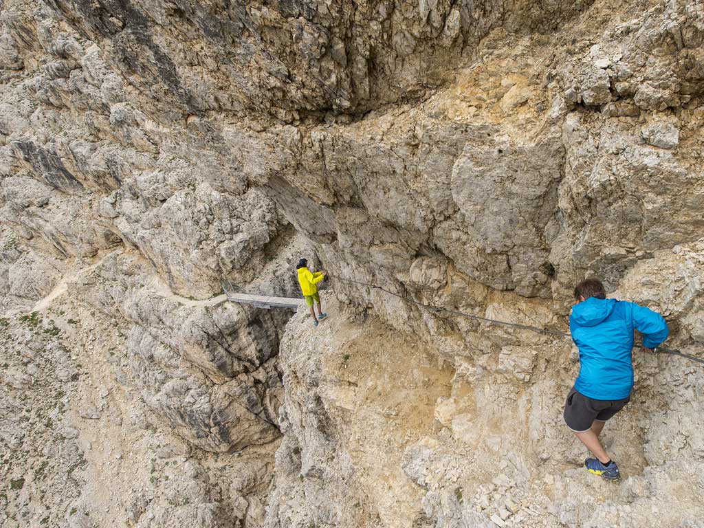
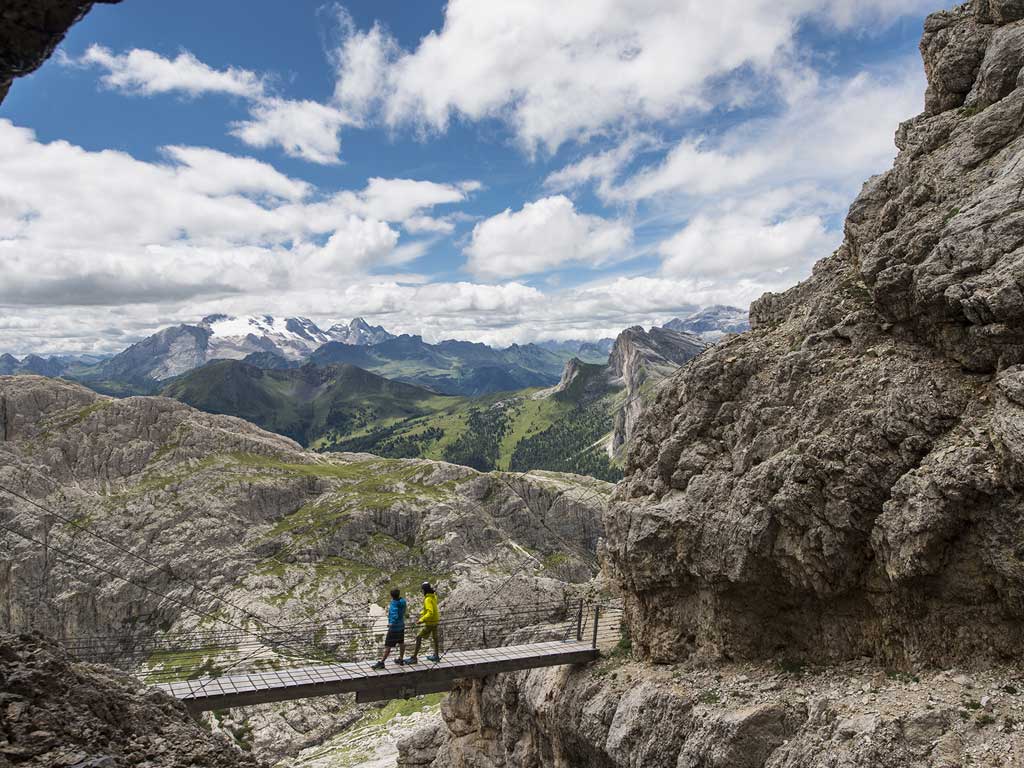
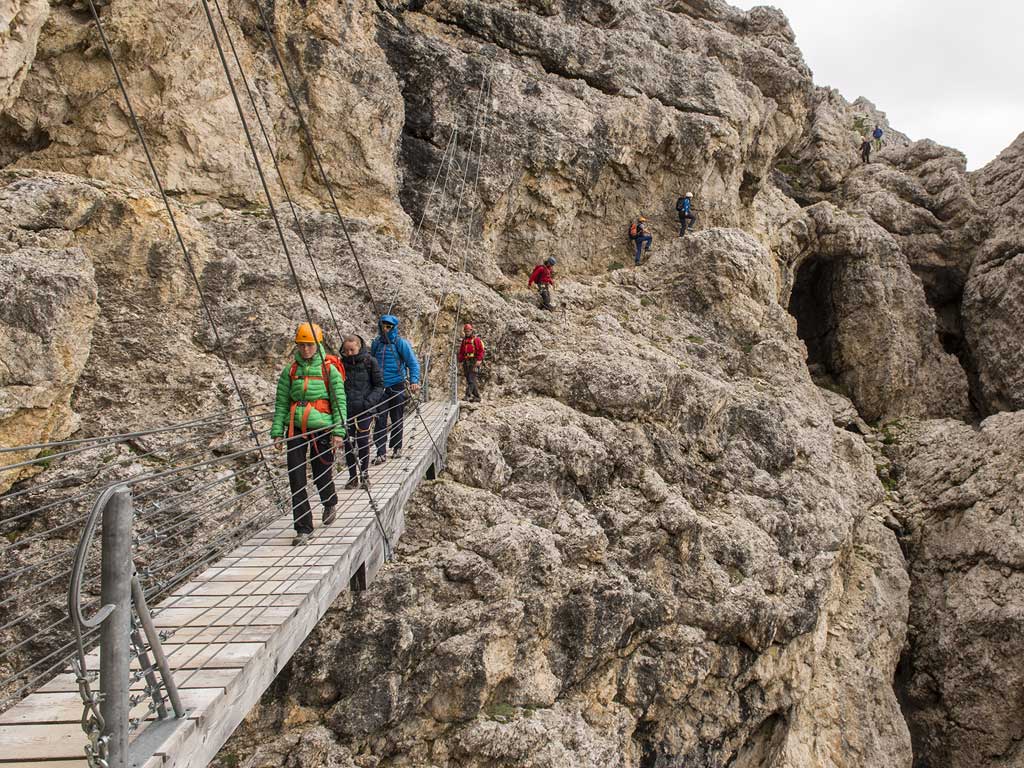
The initial path, no. 402, begins in front of the station of the Lagazuoi cable car. Follow this path for about 100 metres and then join a new path on the left  which rises west over scree. Walk up to the left in the no man's land between the Austro-Hungarian trenches to the west and the Italian trenches to the east. After the Austro-Hungarian trenches continue zigzagging up the path, pass the suspended bridge and reach the start of the equipped path.

Return
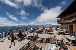
You can descend by cable car, on the Frontline Trail (no. 401-402) or along the path through the Anticima-Tunnel on the fore-summit. This path starts besides the top station of the cable car, winds though the Austrian trenches and takes you to the entrance of the Italian tunnel which runs through the fore-summit.  You get out of the tunnel next to the Malvezzi emplacement and from here you reach the Falzarego pass on path no. 402.

Peak
Piccolo Lagazuoi

Orientation
south west and south